The Unique Landscape of Washington’s Pacific Coast
The unique landscape of PCSC
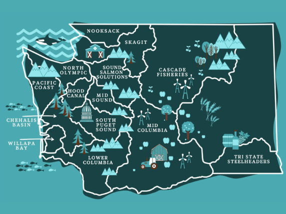
PCSC includes the western portion of the Olympic Peninsula north of the Chehalis River drainage and south of Cape Flattery. This region covers parts of three counties:
Clallam, Jefferson, and Grays Harbor.
There are several significant rivers in this region: the Quillayute River Complex, which includes the Sol Duc, Calawah, Dickey and Bogachiel Rivers; the Hoh River, the Queets River and the Quinault River.
These rivers are glacially fed and have short but steep drops to the ocean. High levels of precipitation characterize the region and streams with cold water, high average flows, and relatively long-duration peak flows during the rainy seasons, including a second peak later in the year from snowmelt.
Much of this area is within the Olympic National Park and Olympic National Forest, the Washington State Experimental Forest, or one of several Native American reservations. The majority of the land base in the river drainage is in timber production. The remaining land base is primarily a mixture of National Park and Native American Reservation.
We believe that local volunteer-based habitat restoration is key to a healthy salmon population.
Salmon Habitat Restoration: A Changing Vision
Wild rivers are the arteries of our planet, circulating soil, rock, plants, and salmon.
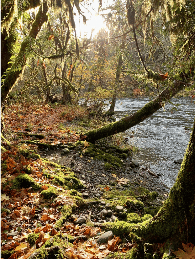
The rivers of the Olympic Peninsula start with glacier melt. The streams rise with the rains and the moon. Then trees fall, dam the flow and create cool protected pools.
In these pools, the fallen woody debris is eaten by the caddis flies, which in turn are eaten by the salmon fry. The fry grow into smolt, and then they swim down river to spend their adult lives in the Pacific Ocean. Eventually, the salmon will follow their noses and the stars to return to their nursery pool, spawn, and die.
Protected from strong surges and predators, these pools are ideal salmon nursery habitat. Each year, the rains come and rearrange the rocks and trees, providing fresh nutrients and new pools.
It is with this vision of natural function and renewal that the Pacific Coast Salmon Coalition (PCSC) works to restore salmon habitat. PCSC is a Regional Fish Enhancement Group whose work spans the western portion of the Olympic Peninsula, from south of Cape Flattery to north of the Chehalis River drainage. We formed in 1990 in Forks, Washington with the purpose of monitoring and restoring salmon habitat in our region, with community investment in the form of volunteer hours, local business donations, local contractors put to work, and landowner involvement.
PCSC’s work is focused on obtaining Salmon Recovery Funding Board (SRFB) grants to restore Salmonid Screening, Habitat Enhancement, and Restoration (SSHEAR) project sites. In the 1990s, Washington Department of Fish and Wildlife (WDFW) surveyed the rivers of the Olympic Peninsula and identified 800 off-channel habitat sites with spawning salmonids. Off-channel habitat refers to bodies of water adjacent to a river’s main channel with slower water flow, often including sloughs, alcoves, or wetlands, which are ideal salmon spawning habitat.
Seeking to increase salmon population, WDFW selected over fifty of these off-channel habitat sites for improvements through the SSHEAR project. Concrete structures and fish ladders were installed in the hopes of increasing pond sizes while still enabling fish passage.
For many of these SSHEAR sites, this strategy worked, resulting in more salmon spawning at those sites. But, as nature always does, she changed the river. Now, decades after installation, many of the structures installed on SSHEAR sites have become impediments to fish access.
Last year, PCSC completed work on three SSHEAR sites. One site was Tall Timbers, located on a marshy peninsula of the Bogachiel River. Here in the 1990s, WDFW installed a series of cedar planks as weirs and a concrete dam, with a square opening and a plank fish ladder inside the dam. The intent was to create a pool behind the concrete dam and for fish to enter and exit by the plank ladder.
A 2019 survey at Tall Timbers found that much of the material had rotted or degraded. Upstream, there was evidence of juvenile salmon, indicating the area was being used as habitat, but the fish ladder was deteriorating and soon could completely block access to the pond used by juvenile salmon for rearing. So, PCSC obtained a SRFB grant to restore the site.
With designs from WDFW salmon habitat biologists and engineers and labor from local contractors and volunteers, we removed the concrete structure and replaced it with all-natural materials found on the site. Our goal was to mimic the natural formation of pools.
The project began with an evaluation of site designs followed by a "de-fishing" process, conducted in collaboration with the Wild Salmon Center, to safely relocate aquatic species and install nets to prevent debris and additional fish from entering the work area.
To maintain water level in the pond created by the concrete structure, we put wooden posts in the mud. We then used fir and hemlock branches in an alternating wicker weave pattern, like a basket, to form a dam, a technique known as a Beaver Dam Analog (BDA). When we carefully removed the concrete structure to prevent downstream flooding we were pleased that the pond’s water level was maintained by the BDA.
Downstream from the BDA, we felled trees, strategically placed logs along the banks to influence hydrological flow, and anchored the logs to prevent erosion. We also added 150 yards of gravel to enhance spawning habitat and soil stability, and to achieve a suitable stream gradient between the BDA and lowest plank weir. We then replanted more trees along the banks, in hopes that they grow, reseed, and eventually fall into the channel.
Returning to the site, it now appears that nature is ready to take back over maintenance of these pools. By using all natural materials found local to the site we have encouraged the creation of ideal nursery conditions, but the BDA does not hold on too tight to block the natural changes of the river. In future decades when we return to this site, we may see logs and gravel rearranged, but the salmon will still be spawning.
This summer, we are completing restoration of a SSHEAR Site called Morganroth Springs located along the Bogachiel Rain Forest trail, near the entrance to the Olympic National Park.
Our Region - The Pacific Coast
The Pacific Coast Salmon Coalition is one of fourteen Regional Fisheries Enhancement Groups (RFEGs) in Washington State.
As independent nonprofits, the RFEGs are community-driven.
We know the rivers in our regions intimately, and we know our communities.